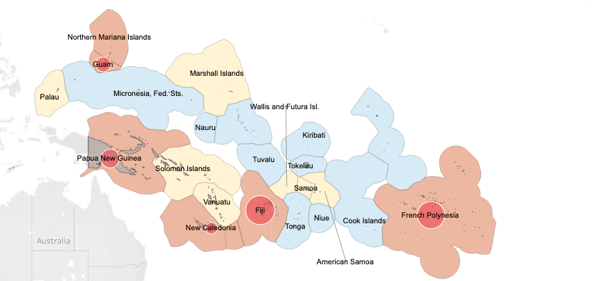
Mapping the COVID-19 response in the Pacific

The map shows that, since the first cases were recorded in the region in March 2020, it has spread to 12 countries and territories, while ten remain virus-free – a significant achievement. As the circles, and colour coding highlights, case numbers and the extent of community transmission have varied widely between countries.


See Data Map

Infographics

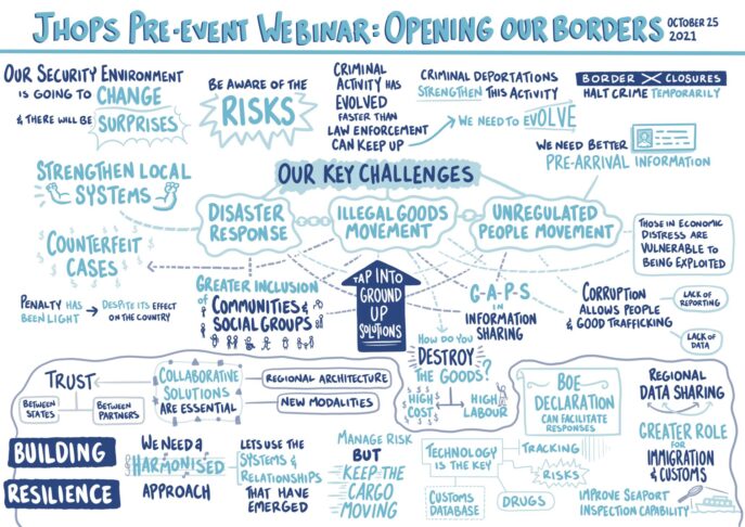
JHOPS Pre-event Webinar: Opening Our Borders

JHOPS Pre-event Webinar: Opening Our Borders

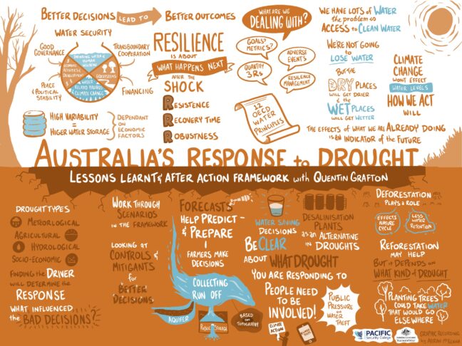
Australia's Response to Drought

Australia's Response to Drought

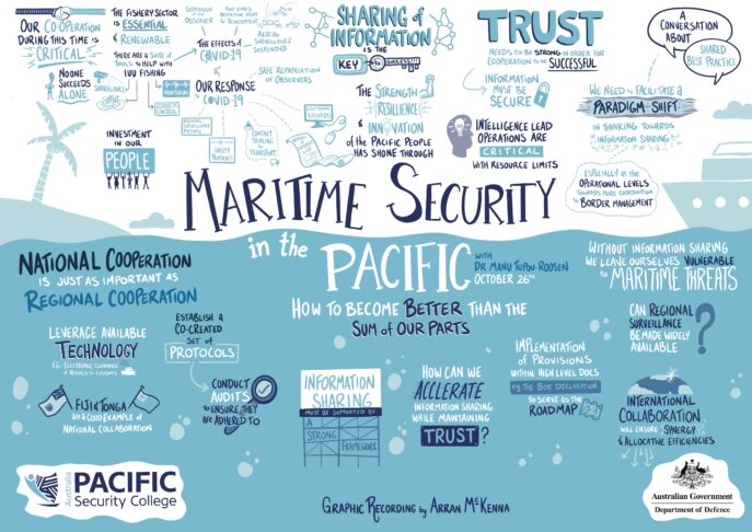
Maritime Security in the Pacific

Maritime Security in the Pacific

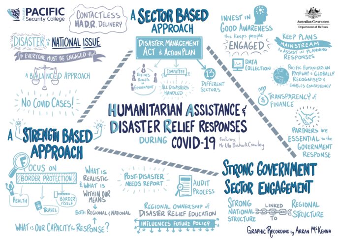
Humanitarian Assistance & Disaster Relief Responses during COVID-19

Humanitarian Assistance & Disaster Relief Responses during COVID-19

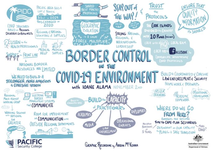
Border Control of the COVID-19 Environment

Border Control of the COVID-19 Environment

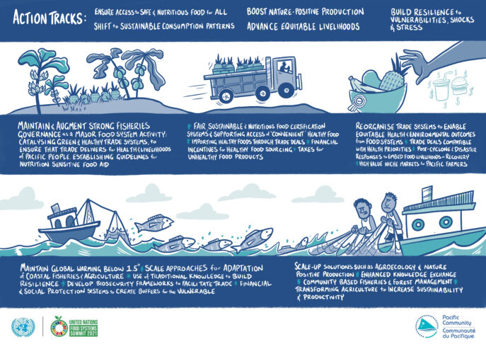
Pacific Food Networks: Action Tracks

Pacific Food Networks: Action Tracks

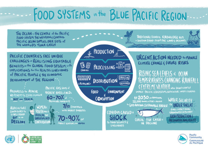
Food Systems in the Blue Pacific Region

Food Systems in the Blue Pacific Region

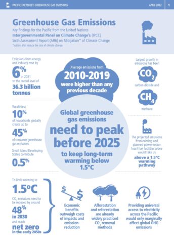
Greenhouse Gas Emissions: IPCC Pacific Factsheet

Greenhouse Gas Emissions: IPCC Pacific Factsheet

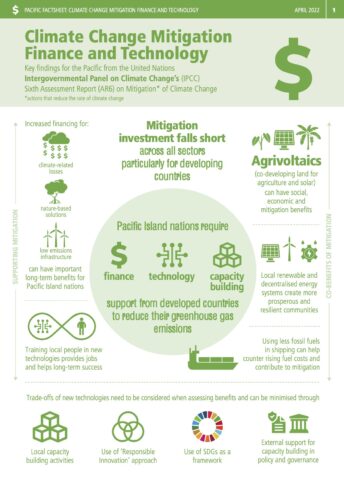
Climate Change Mitigation: IPCC Pacific Factsheet

Climate Change Mitigation: IPCC Pacific Factsheet

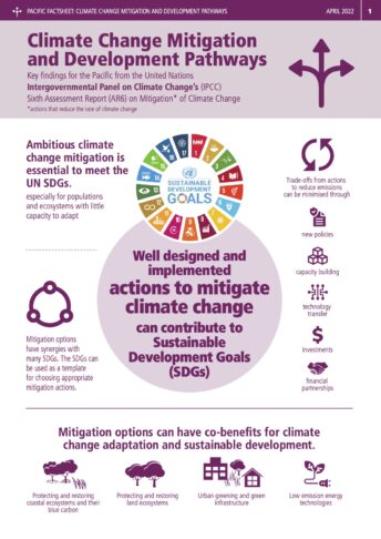
Climate Change & Development: IPCC Pacific Factsheet

Climate Change & Development: IPCC Pacific Factsheet